Twelve works numbered on the council's own map board, most placed in Riverside Park from the late 1980s, on the slope between High Level Road and the Tyne. Walk it from either end; the stops below run east to west. There are two routes, each with its own map below — a shorter one with a very steep bank, and a step-free one for wheelchairs and buggies.
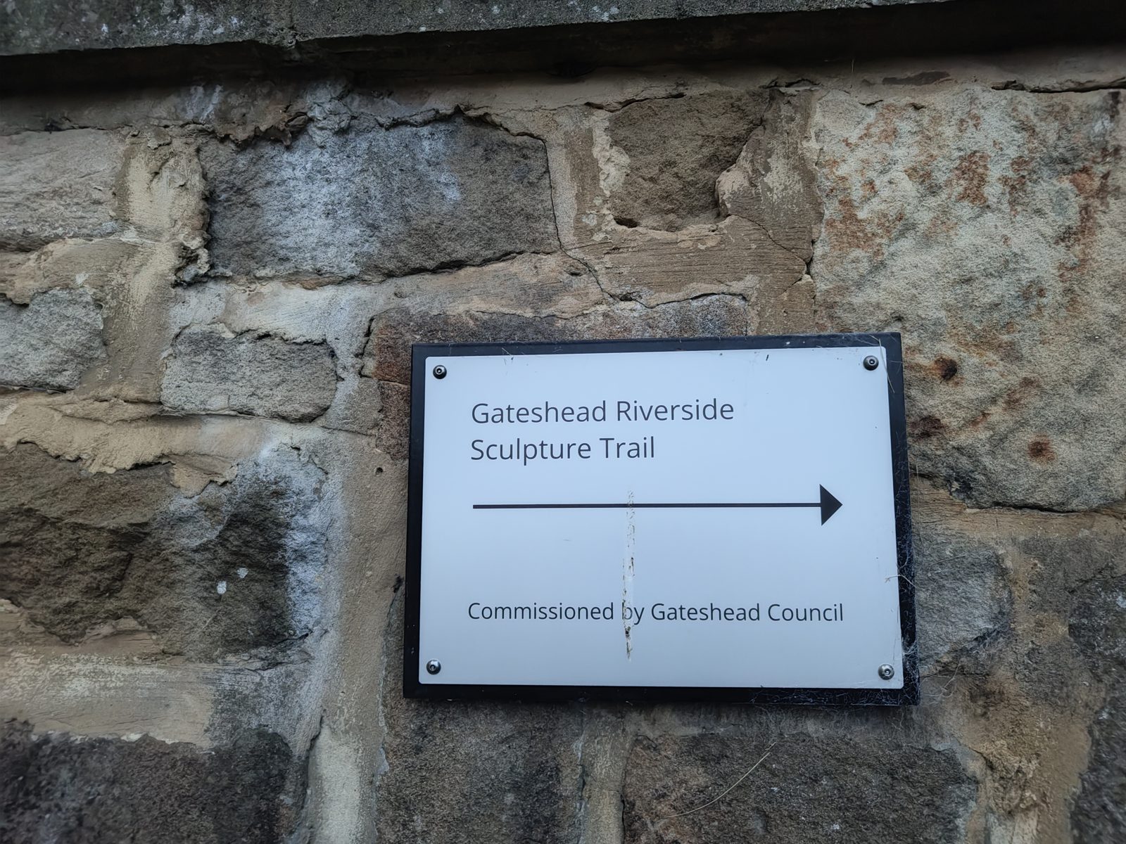
The council's trail signs are fixed to the walls along the riverside path. September 2026.
Start: Either end. East: Rise and Fall, reached from either of the two High Level Road entrances. West: the Riverside Entrance arch at the far western end of the park; from there, take the stops in reverse.
Allow about 40 minutes for the trail itself, and about 25 minutes more to walk back along the quayside to where you started.
Artists and dates come from the plaques beside each work and the council’s map board in the park. Nocturne, on the Metro bridge, is beyond the park and not pinned.
The park is also on the Tyne Derwent Way, a nine-mile route along the Tyne and the Derwent, so this trail can be walked as part of a longer day out.
The routes
Steep-bank route, about 2 km
For walkers steady on their feet. Not for wheelchairs or buggies.
Follows the stops in the order below. From Once Upon a Time it climbs a very steep bank to Phoenix Cobbles on the terrace above, then comes back down to the riverside path. The bank is a slope of about 35% (roughly 1 in 3) with a loose surface: take care on it, especially when wet.
Map loads when you scroll here. The links below open it in your own map app.
For wheelchairs, buggies and anyone who would rather avoid the steep bank.
No steps. It stays on the riverside path past Once Upon a Time to the western end, goes up to Rose Street, and follows the street back east to Phoenix Cobbles, so you see the phoenix after Rose Street Features; then back west along the street to the Riverside Entrance. Some of the slopes are long and strenuous. Rise and Fall, at the start, stands on a plinth with a few steps up: you pass right in front of it, but can't reach it by wheelchair.
Map loads when you scroll here. The links below open it in your own map app.
Riverside Park · beside the riverside path below the east entrance; the path past it is step-free, the plinth has a few steps up · NZ 2521 6356 · map
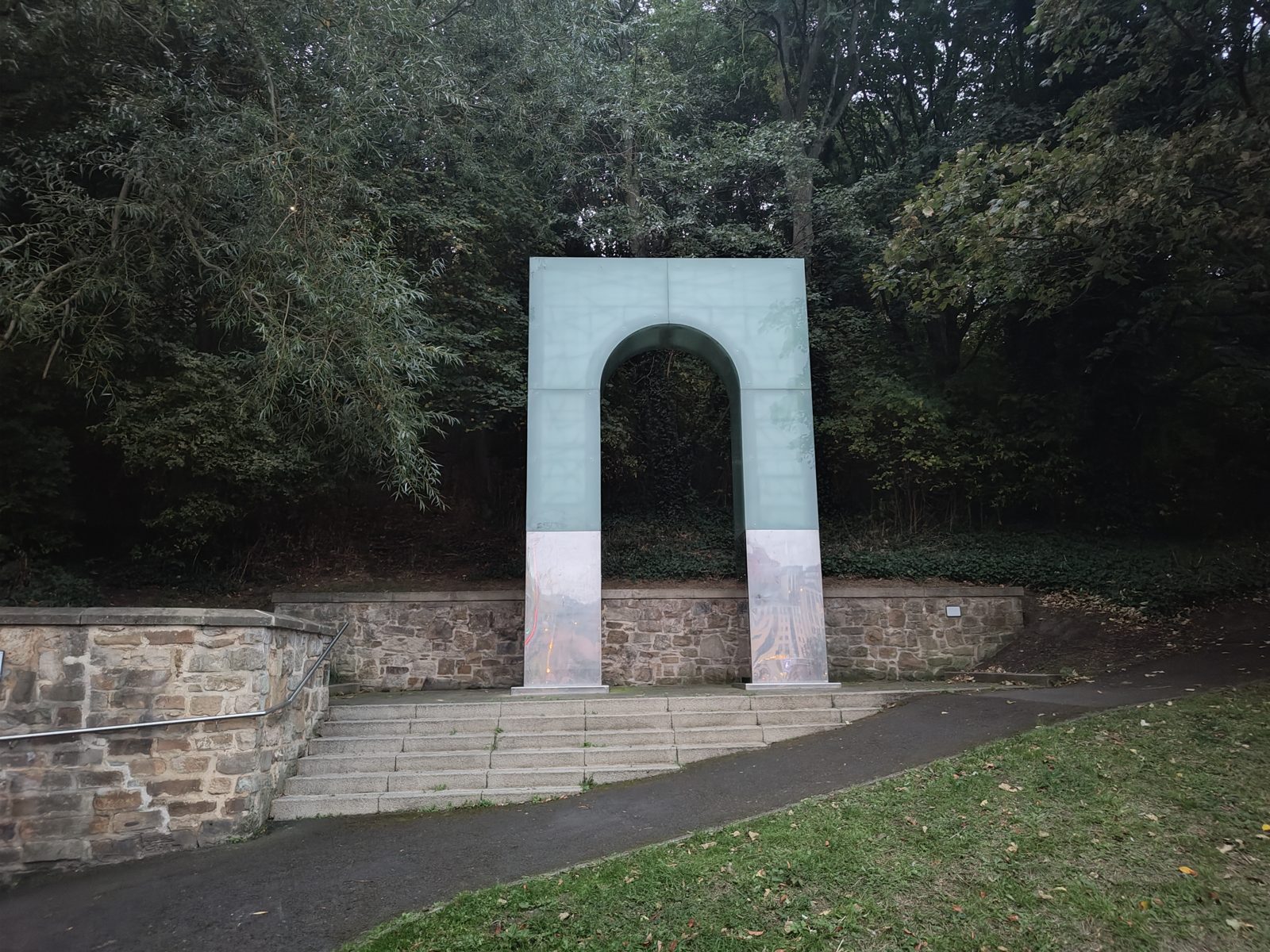
Lulu Quinn, 2007. A full-height arch of frosted glass panels on polished steel legs, an echo of the railway arches above the park, set on a plinth of steps against the retaining wall; the steel reflects the river and the bridges, the glass takes the light. It stands on a small raised plinth with steps up to it, so it can be seen close up from the path but not reached by wheelchair. The council's Riverside Sculpture Trail signs point the way along the path from here.
Rise and Fall, Lulu Quinn, 2007. September 2026.
2
Cone
In the woodland below High Level Road, near the west entrance to the park; look down through the trees from the path · NZ 2512 6341 · map
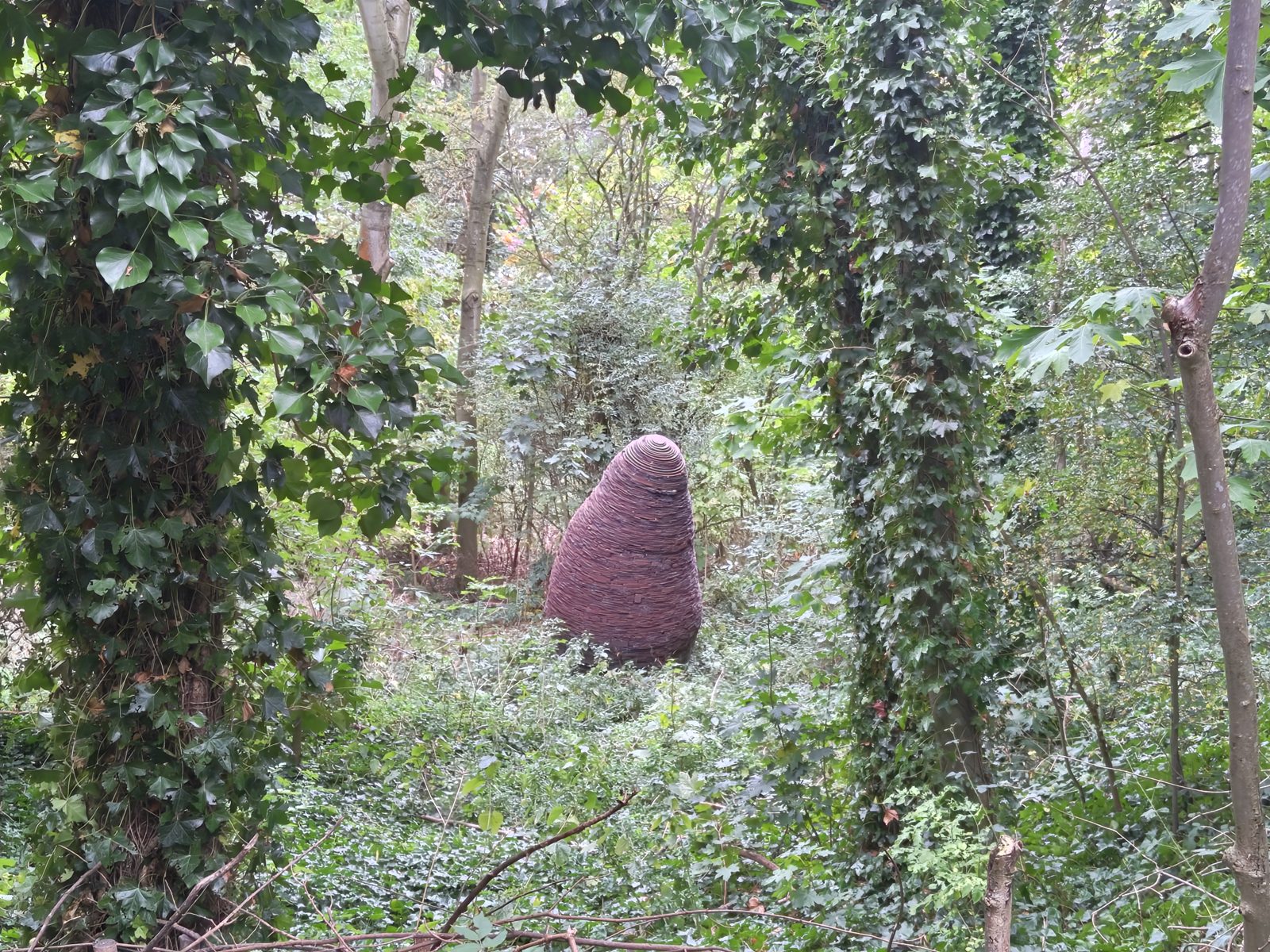
Andy Goldsworthy, 1992. A tall, rounded cone built up from hundreds of thin layers of steel plate, rusted to a deep red-brown, standing on its own in a clearing among ivy-covered trees. Goldsworthy is best known for work made from leaves, ice and stone that decays back into the landscape; here he used steel plate, the material of Gateshead's heavy industry, to make a natural form. It belongs to a series of cones he made in different materials, with others in France, South Australia and Dumfriesshire. The plaque on its post misspells his name as Goldworthy.
Cone, Andy Goldsworthy, 1992, in the woodland below High Level Road. September 2026.
3
Rolling Moon
On the wooded path through the park, arching over the grass beside it · NZ 2502 6338 · map
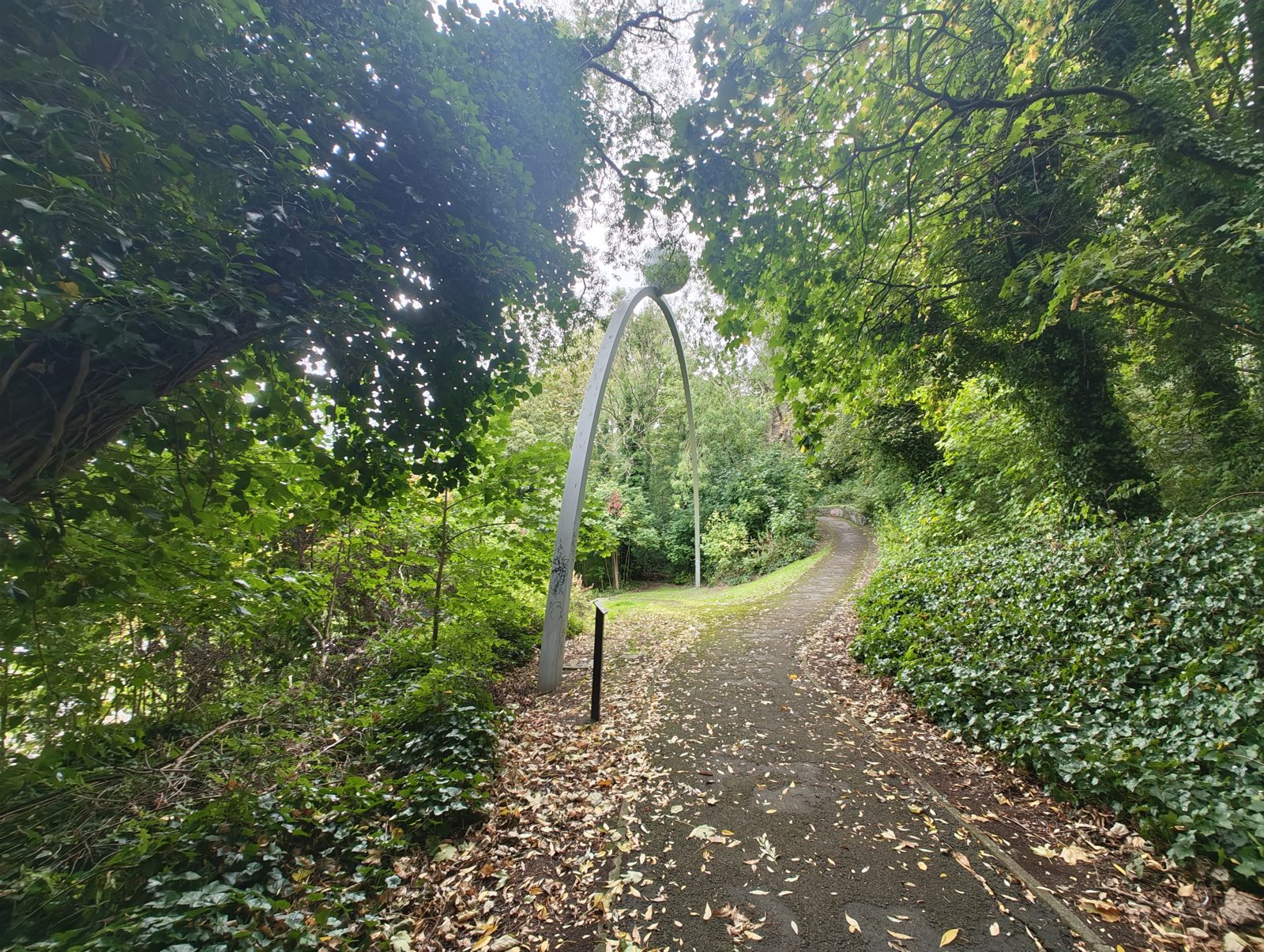
Colin Rose, 1990. A slender arch of steel 27 metres long, rising to 11 metres, with a polished steel moon balanced at its top: the moon's pull on the tides. It was made for Gateshead's exhibit at the 1988 Glasgow Garden Festival and moved to the bank of the Tyne in 1990; it is one of the best-known public artworks in the borough. The plaque on its post confirms the artist and date but has been tagged with graffiti.
Rolling Moon, Colin Rose, 1990. September 2026.
4
Thornbird Railings
Along the footpath beside Pipewellgate, below Rolling Moon; the plaque is on the bank above · NZ 2501 6338 · map
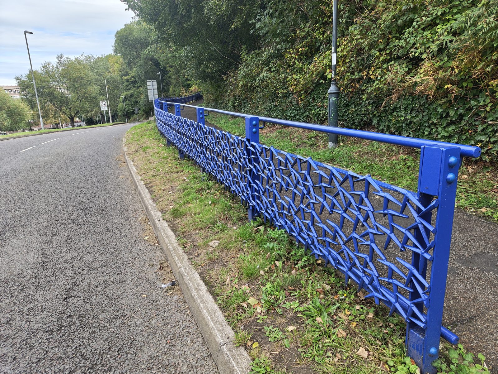
Marcela Livingston, 2005. A long run of bright blue cast railings between the road and the footpath, the panels filled with a scatter of sharp, star-like shapes: 25 panels whose repeating pattern, the council's map board says, represents falling leaves or a bird's wing. It follows the curve of the road for some distance: functional railings made into a sculpture you walk alongside.
Thornbird Railings, Marcela Livingston, 2005, beside Pipewellgate. September 2026.
5
Goats
On the wooded bank above a stone wall · NZ 2494 6334 · map
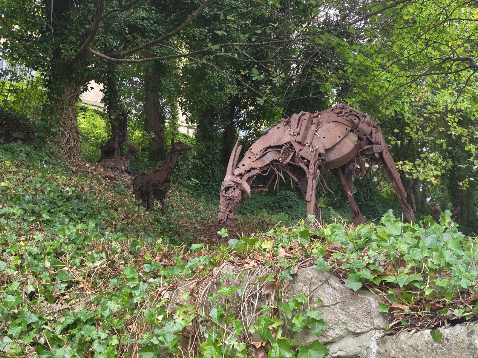
Sally Matthews, 1992. A small herd of life-size goats made from scrap and rusted steel, one grazing with its head down at the top of the bank and others climbing the slope behind it among the ivy. Easy to walk past until one of them catches your eye.
Goats, Sally Matthews, 1992. September 2026.
6
Riverside Rivets
Riverside path, in three groups about 130–140 metres apart: the first beside the bridge pier (the pin), the second further west, the third in the trees beyond Once Upon a Time · NZ 2474 6309 · map
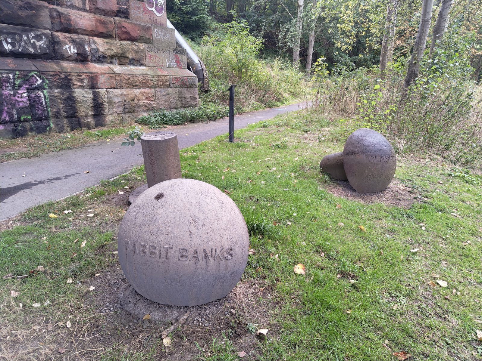
Andrew McKeown, 2010. Giant stone rivets scattered along the path as if sprung from the bridge, each carved with the name of a community beside the riverside, such as Rabbit Banks and Clasper. According to the council's map board, local children made casts of their favourite objects, which are sealed inside the rivets. The second group is a domed head and a separate shank on the edge of the path, carved Teams; the third a single whole rivet lying on its side among the trees. Each group has its own plaque. Sadly the rivets in the second and third groups are heavily sprayed with graffiti, and their carved names are hard to read; only the plaque at the second group is clean.
Riverside Rivets, Andrew McKeown, 2010, by the bridge pier. September 2026.
7
Once Upon a Time
Riverside path, between the second and third groups of rivets; look up at the stone wall above the path · NZ 2457 6297 · map
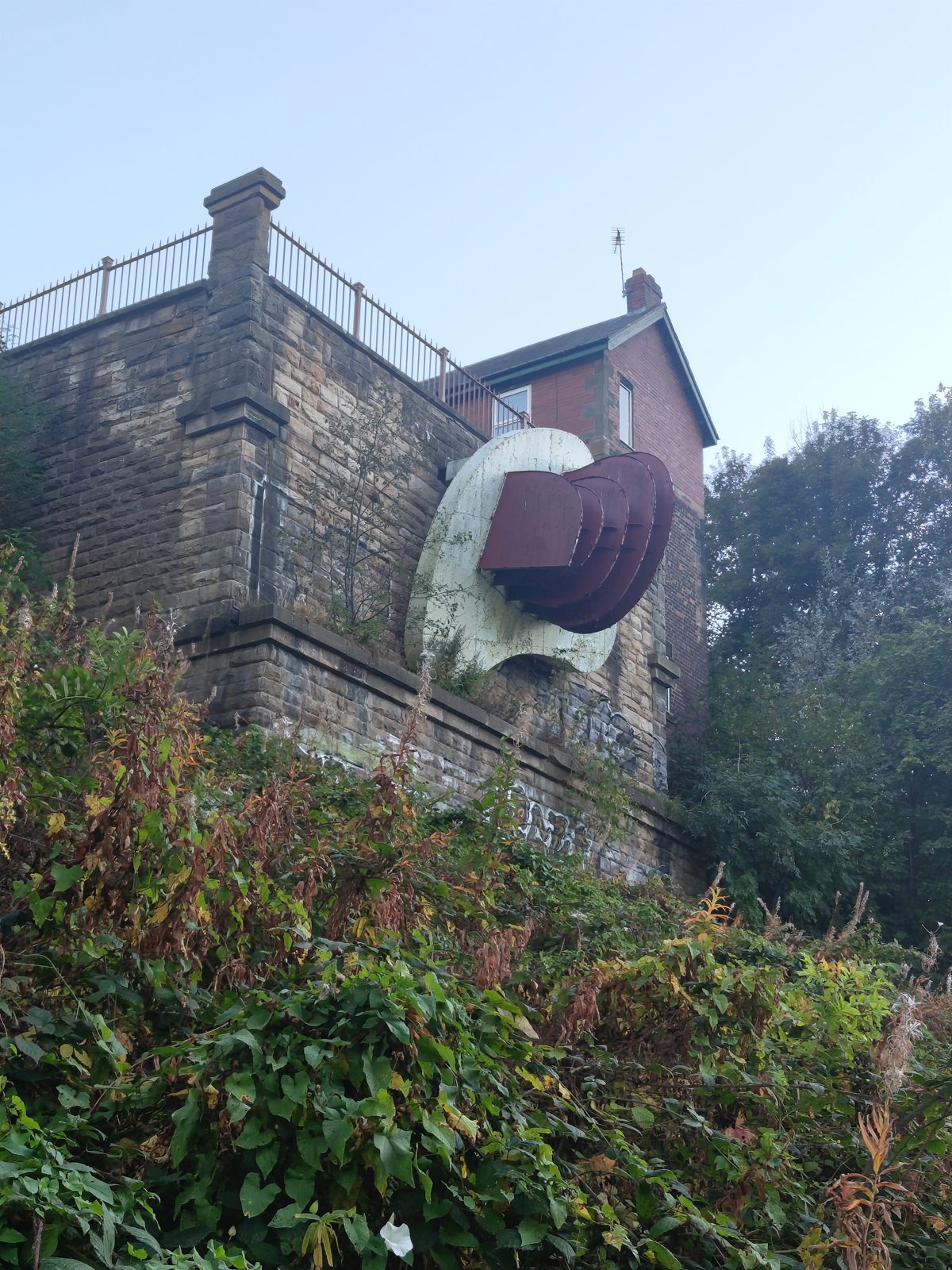
Richard Deacon, 1990. A large white disc fixed high on the side of a sandstone wall, with a curved shell of rust-red steel plates stepping out from it. It stands on the surviving abutment of the demolished old Redheugh Bridge, and the council's map board says it was inspired by the surrounding architecture, linking to the past industries along the Tyne. Deacon, who won the Turner Prize in 1987, is known for sculpture built up from bent and joined sheet materials. It is easy to miss from the path: the plaque is at ground level among the undergrowth, the work well above it.
Once Upon a Time, Richard Deacon, 1990. September 2026.
8
Phoenix Cobbles
On the paved terrace at the top of the old Redheugh Bridge abutment, beside the brick house, a few metres from Once Upon a Time on the wall below · NZ 2458 6294 · map
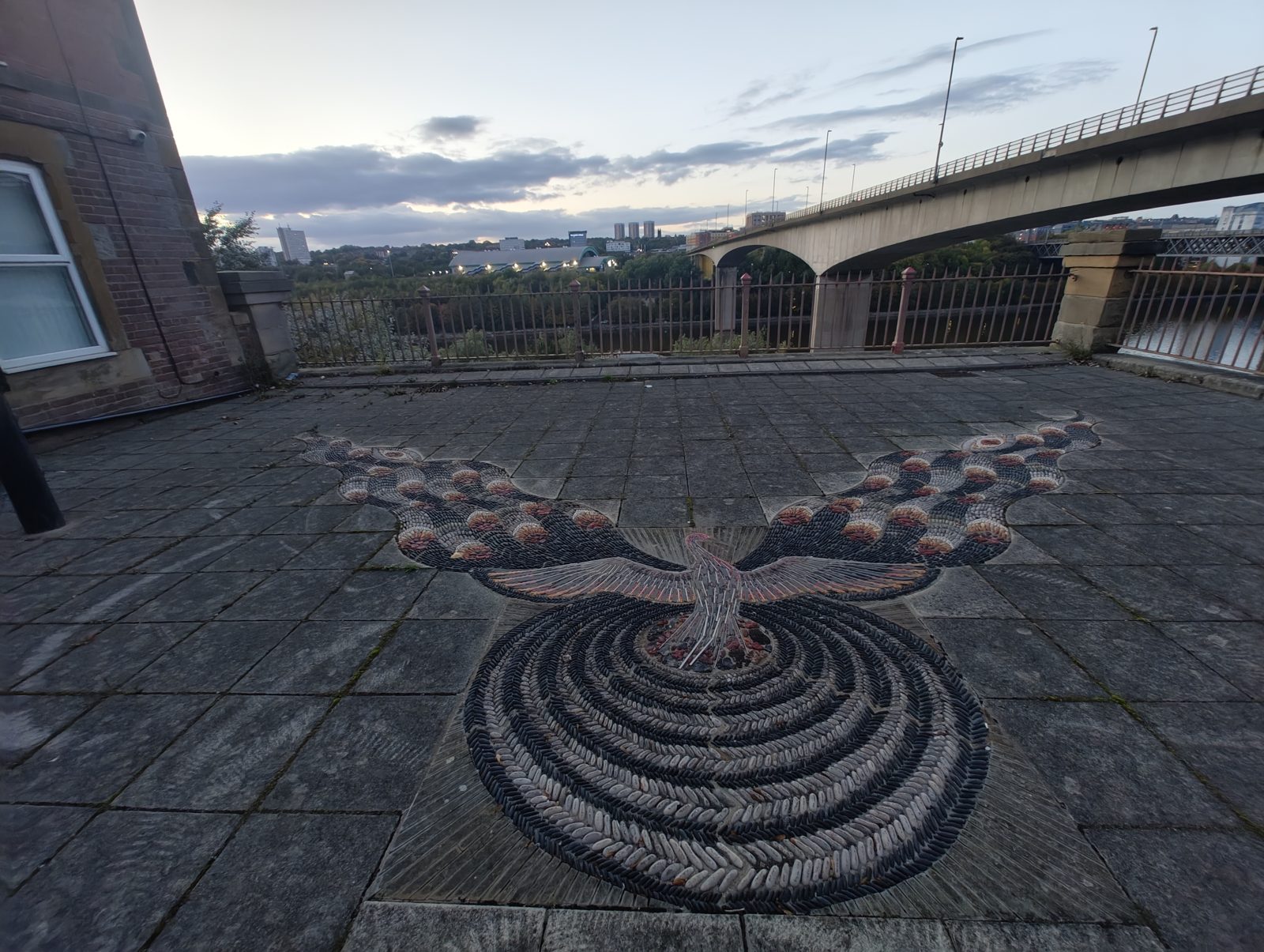
Maggy Howarth, 1994. A pebble mosaic set into the paving: a pale phoenix with outspread wings rising from a whirl of black and grey pebbles, framed by two great flame-tipped plumes of red, amber and cream. The council's map board gives its theme as revival, Gateshead's regeneration after a period of industrial decline. The terrace is a viewpoint in its own right: the Tyne below, the Redheugh Bridge alongside and Newcastle across the river.
Phoenix Cobbles, Maggy Howarth, 1994, with the Redheugh Bridge beyond. September 2026.
9
Foliate Form
Riverside path west of the Redheugh Bridge, on the grass above the river railings · NZ 2443 6291 · map
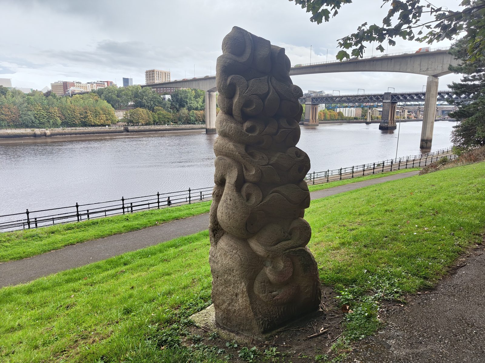
Gilbert Ward, 2010. A column over three metres high, carved from Blaxter stone, a Northumberland sandstone, of coiling leaves and scrolls, rising out of the bank like a column of foliage; it was placed to be seen from the Centrelink bus route below as well as from the park. Stand behind it for the view east: the Redheugh Bridge carrying the road, the King Edward VII Bridge carrying the railway behind it, and the city beyond.
Foliate Form, Gilbert Ward, 2010, looking east to the Redheugh and King Edward VII bridges. September 2026.
10
Carved boulder (unidentified)
On the grass beside the path, a little west of Foliate Form; the council's map board of the park is about 5 metres away · NZ 2434 6283 · map
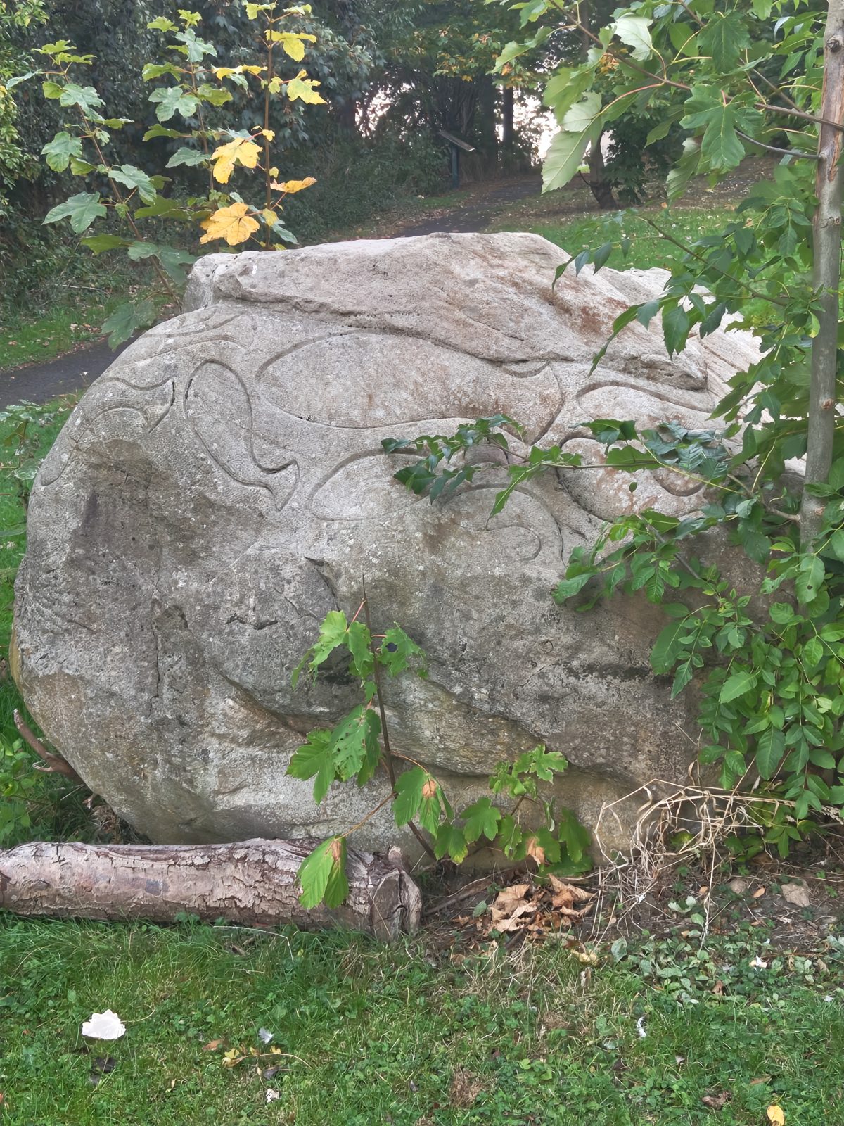
A large sandstone boulder carved in low relief with flowing, interlocking shapes, like fish or leaves swirling in a current, left rough elsewhere so it still looks like a rock that has rolled to rest on the bank. There is no plaque, and it is not among the twelve works on the council's map board. The council's map board a few steps away numbers the park's twelve works and describes each one, though it is badly weathered and covered in graffiti. If you know who made the boulder, or when, please tell us.
The carved boulder west of Foliate Form. Artist and date not known. September 2026.
L · likely
11
Rose Street Features
At the Rose Street entrance, on the street just above the carved boulder · NZ 2438 6283 · map
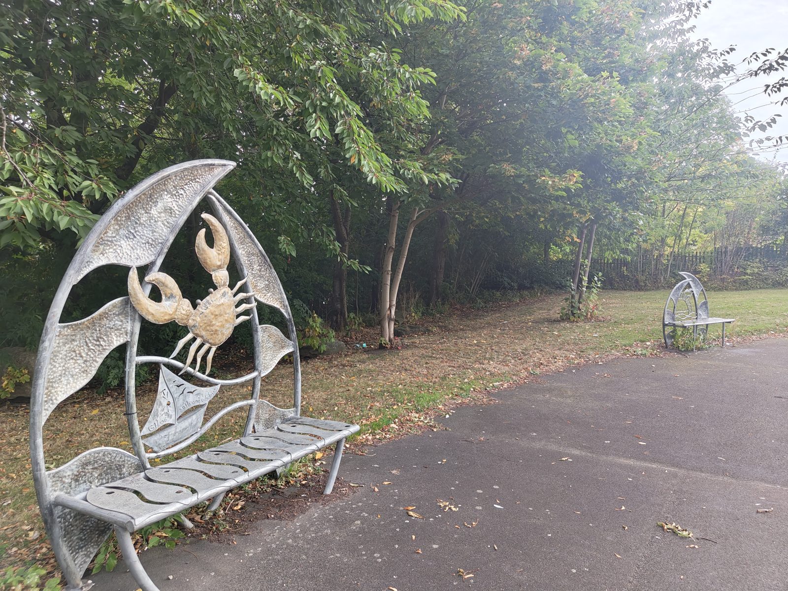
Graeme Hopper, 2005–2006. A set of galvanised steel pieces around a paved circle on the path: tall sail-shaped posts bound like masts, and curved benches whose backs frame hammered-metal scenes of the river — a crab over a sailing ship, waves, gulls. The council's map board describes an entrance, railings and seating in mild steel on a sea theme. Sit on it: this is the one sculpture on the trail made for resting.
Rose Street Features, Graeme Hopper, 2005–2006. September 2026.
12
Riverside Entrance
The far western end of the park, where the path enters under the arch · NZ 2402 6249 · map
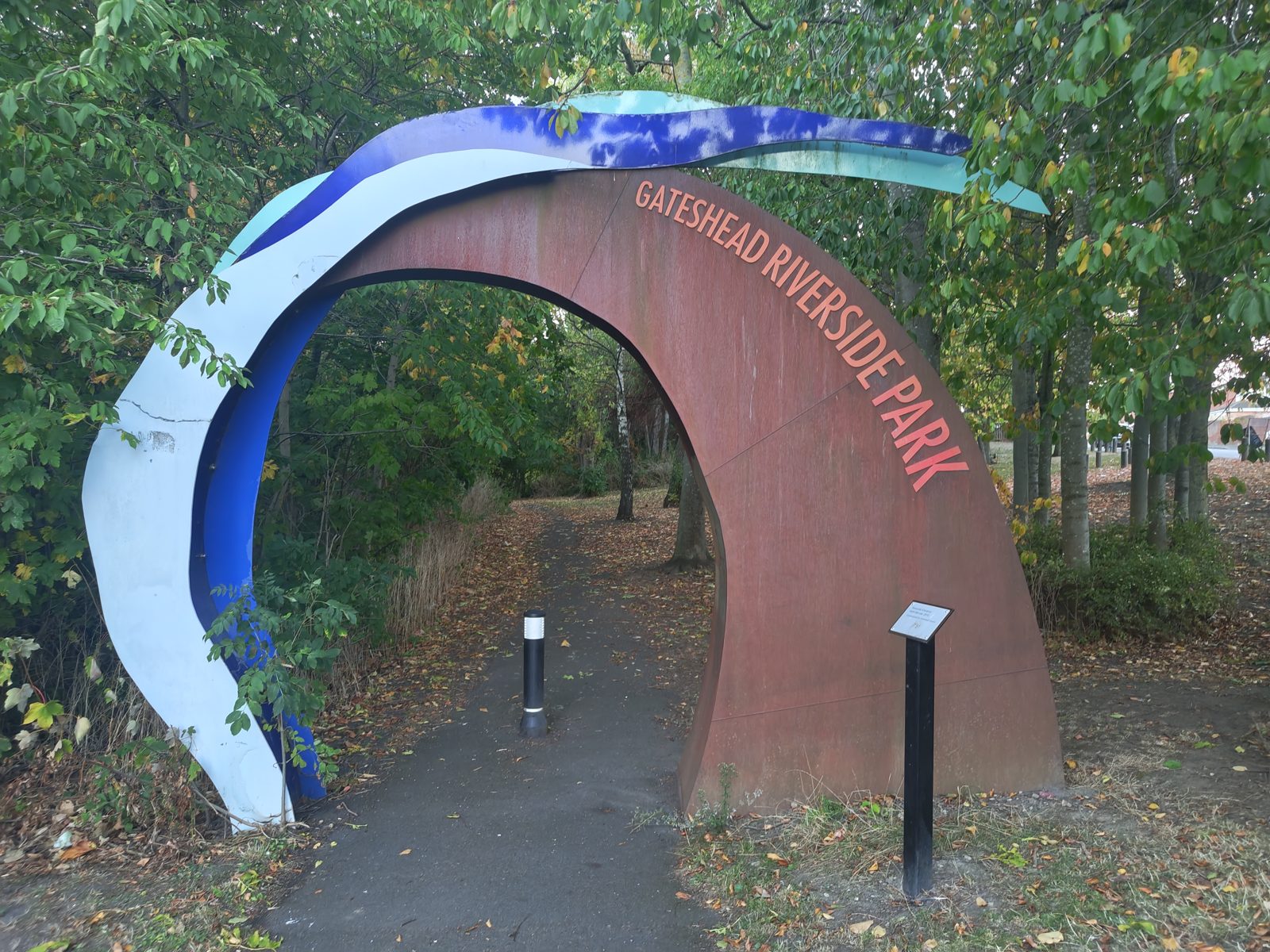
Keith Barratt, 2010. A gateway arch of rusted Corten (weathering) steel lettered GATESHEAD RIVERSIDE PARK, with a breaking wave of blue, white and turquoise painted steel curling over the top. The council's map board calls it Entrance Feature and spells the artist Barrett; the plaque beside it gives Riverside Entrance and Barratt, which we follow. Coming in from this end, walk the trail in reverse.
Riverside Entrance, Keith Barratt, 2010, at the western end of the park. September 2026.
13
Nocturne (beyond the trail)
On the Queen Elizabeth II Bridge, the Metro bridge over the Tyne just east of the High Level Bridge; not on the park path
Nayan Kulkarni, 2007. Commissioned by Nexus, the Metro's operator, and opened on 26 April 2007: the bridge was painted in two distinct tones of blue, and at night 140 LED floodlights played an ever-changing pattern of colours based on photographs sent in by the public. With it, all five main bridges between Gateshead and Newcastle had their own lighting. The lights were reported switched off by 2021, with Nexus citing running costs, and they were still off in October 2026; the bridge's blue and white colours can still be seen by day. It is number 12 on the council's map board in the park. If you see it lit again, please tell us.