Hub
Greenesfield Business Centre
Gateshead Council's small-business centre on Mulgrave Terrace, on the site of Greenesfield House, the villa where Vincent Raven lodged as an apprentice; the house's gates and part of its boundary wall still stand.
Last checked · Report a correction
| Where | Just outside the district, about 6 minutes' walk from Fletcher Road. Nearby |
|---|---|
| Address | Mulgrave Terrace |
| Open to the public | Yes |
| Website | www.gateshead.gov.uk/article/3339/Greenesfield-Business-Centre |
| Confidence | C · confirmed |
Map loads when you scroll here. The links below open it in your own map app.
Where it is
NZ 2525 6316 OS grid · 54.96245, -1.60717
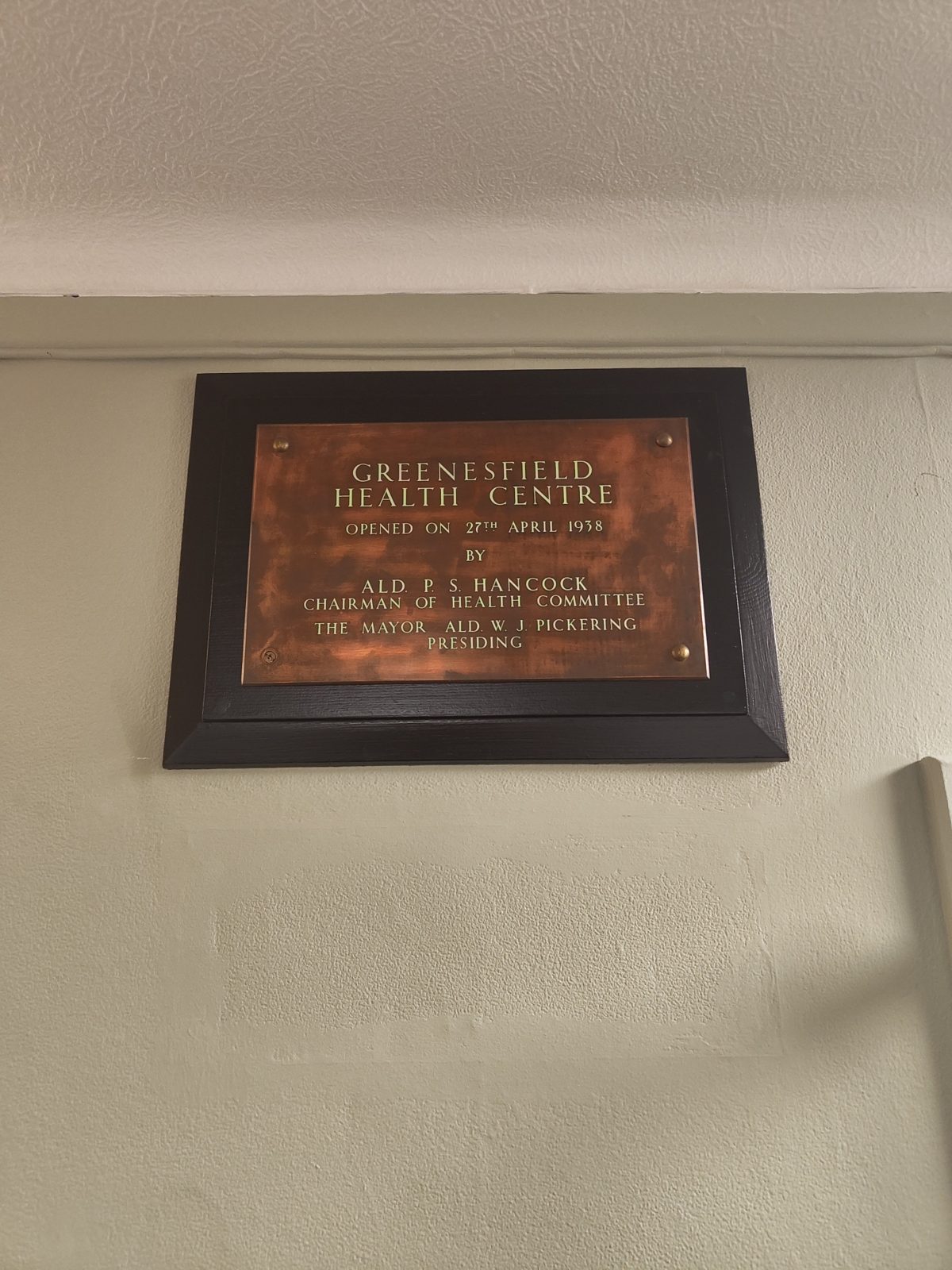
Council-run offices and workshop units for small businesses, a few minutes up the hill from the estate. The interest for this site is what stood here before. Greenesfield House (HER 16157) was a detached villa shown on the 1856 Ordnance Survey plan, on land that had been Green’s Field — the nine acres the Brandling Junction Railway bought from Lord Ravensworth for £8,700, named for Joshua Green, the grocer whose tannery stood in Mirk Lane. Vincent Raven lodged in the house when he began his apprenticeship at the works in 1877. From about 1920 the house was Gateshead’s public health department, holding the school clinic, welfare clinics and the sanitary inspectors; the Medical Officer of Health’s 1936 report calls it “a converted mansion house” so overcrowded that health visitors worked six to a room. The answer was Greenesfield Health Centre, built in the house’s grounds at the corner of Askew Road and Mulgrave Terrace, and its copper opening plaque is still on the wall inside: “opened on 27th April 1938 by Ald. P. S. Hancock, Chairman of Health Committee, the Mayor Ald. W. J. Pickering presiding”. The house was not pulled down for it: the 1938 report is headed “Public Health Department, Greenesfield House, Mulgrave Terrace”, and the 1972 report still lists “Greenesfield House and Health Centre, Mulgrave Terrace” among the borough’s clinics. The council later converted the health centre into the business centre. The 1896 Ordnance Survey town plan, at 1:500, shows the house as an L-shaped villa standing in its own walled grounds, with outbuildings and a glasshouse behind it, a curving drive, and a belt of trees along its south-west side facing Clarke Street, all within the triangle of land between the railway and Mulgrave Terrace. Laid over a modern aerial photograph, the business centre and its car park sit within the same triangle, so the plot has kept its shape even though the house has gone.
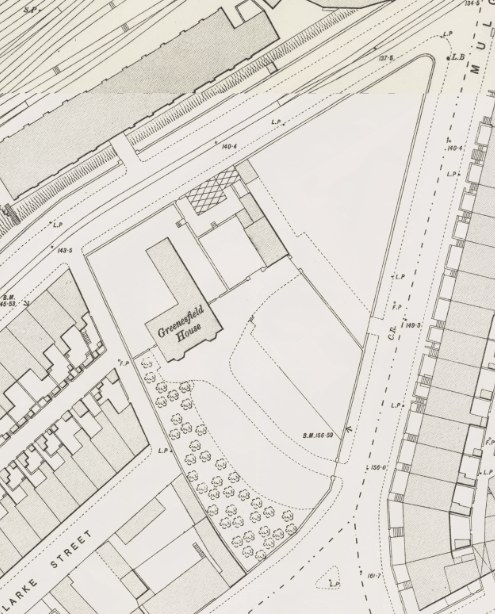
Greenesfield House on the Ordnance Survey 1:500 town plan, 1896. Reproduced with the permission of the National Library of Scotland, CC-BY.
The original gates and a stretch of the villa’s boundary wall survive on Mulgrave Terrace: the pin above is on them. The house was still standing on the Ordnance Survey 1:1250 plan revised in 1968 (sheet NZ2563SW), where the site is marked “Clinic”, and on the 1972 edition. On that plan, today’s business centre is the triangular block around a courtyard at the Mulgrave Terrace end, with the smaller building just south of it; a short corridor added later joins the two into one. The house is the large stepped block at the west end of the triangle, towards Clarke Street, with a smaller outbuilding between it and the health centre. Both of those are gone. It has since been demolished, and when is not yet known. A Historic England photograph catalogued as Greenesfield House, Mulgrave Terrace, is dated December 2002, which would put the demolition after that, around the time Ochre Yards was being built; we haven’t been able to see the photograph to check. If you remember the house or when it went, tell us.
Coming up
- Wed 4 Nov · 18:00 Introduction to Alterations - Evenings · Green Heart Collective
- Tue 17 Nov · 18:30 November Alternative Community Sewcial · Green Heart Collective
- Thu 19 Nov · 10:30 Introduction to Sewing - Mornings · Green Heart Collective
- Tue 8 Dec · 18:30 December Alternative Community Sewcial · Green Heart Collective
Read from the venue's listings, checked 1 November. Times and line-ups change: check the full list before you go. Everything on nearby.
- Ordnance Survey 1:500 town plan of Gateshead, 1896 — National Library of Scotland
- Gateshead Council — Greenesfield Business Centre
- Tyne and Wear HER 16157 — Greenesfield House
- Medical Officer of Health, Gateshead — annual report 1936 (Greenesfield House 'a converted mansion house'; the new health centre planned in its grounds) — Wellcome Collection
- Medical Officer of Health, Gateshead — annual report 1938 (headed Public Health Department, Greenesfield House; the health centre opened) — Wellcome Collection
- Medical Officer of Health, Gateshead — annual report 1972 (Greenesfield House and Health Centre, Mulgrave Terrace) — Wellcome Collection
- Ordnance Survey 1:1250, sheet NZ2563SW, revised and published 1968 (National Grid maps, 1944–1975) — National Library of Scotland
- Opening plaque inside the building, photographed September 2026
- Andy, on the ground, September 2026 (the surviving gates and wall)